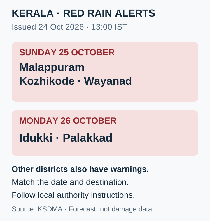
Malappuram, Kozhikode and Wayanad are under a red rain alert for 25 October 2026; Idukki and Palakkad are listed for 26 October. Those are the date-specific warnings in the Kerala State Disaster Management Authority notice issued at 13:00 IST on 24 October. They are forecasts requiring preparedness, not a report that every place in those districts has already flooded.
The India Meteorological Department’s Kerala forecast, also issued on 24 October, warns of extremely heavy rain on 25 and 26 October, with thunderstorm and lightning warnings. The state-level outlook explains the wider risk window; the district list tells residents and visitors where the highest alert applies on each day.
Red-alert districts by date
| Date(IST) | Districts |
|---|---|
| 25 October 2026 | Malappuram · Kozhikode · Wayanad |
| 26 October 2026 | Idukki · Palakkad |
KSDMA notice issued 24 October 2026 at 13:00 IST. Other districts also have orange/yellow warnings. This is not a list of confirmed flooding or closures.
Read the date before reading the colour
For 25 October, the red list concentrates on the three named northern districts. On 26 October it shifts to Idukki and Palakkad. A traveller going to Wayanad on Sunday and Idukki on Monday therefore needs to read two separate daily entries. Carrying one day’s district list into the next would miss the change in the official warning.
KSDMA also lists orange and yellow alerts in other districts. Absence from the red list is consequently not an all-clear. IMD’s next state-level entry is heavy rain on 27 October; the forecast then shows no warning for 28–30 October at the time of issue. A later bulletin can change that outlook, so the dated map remains more useful for a journey than an undated screenshot.
Local terrain and access determine the practical risk
KSDMA warns that intense rainfall can produce flash flooding and waterlogging, while continued rain can raise landslide risks. It advises people in vulnerable hill areas to prepare to move to safer places during daylight and people in low-lying areas to identify local relief arrangements. The practical concern is whether a safe route and place to stay remain accessible as the weather worsens.
For a visitor, the decision is more specific than whether it is raining at the starting point. The destination, approach road and return journey may cross different warning areas. Treat the official district and date as the first check, then seek the current local instruction for the route. This is a way to apply the warning, not a prediction that every journey will be disrupted.
Before travel: check the map, local guidance and emergency contacts
KSDMA advises avoiding unnecessary travel, night travel in hilly areas and visits to waterfalls or other water bodies during the warning period. Do not enter or cross swollen rivers. The notice lists 1077 and 1070 for round-the-clock disaster control-room assistance. The links below lead to the KSDMA notice and IMD district map; select 25 or 26 October to match the planned journey.
The practical response is to prepare before access deteriorates: know the safer destination and route identified by local authorities, and act on their instructions. A red alert is useful because it creates that preparation window. Keep the issue date attached to this guide and use the next official update when it replaces the current forecast, rather than treating a colour as a permanent condition.
KSDMA notice issued 24 October 2026 at 13:00 IST, checked against IMD’s 24 October forecast. These are forecast warnings, not observed damage or closure reports.
- KSDMA: district rainfall alerts and public precautions, issued 24 October at 13:00 IST ↗
- IMD: Kerala subdivision warnings issued 24 October 2026 ↗
- IMD: district warning map, select the forecast date ↗