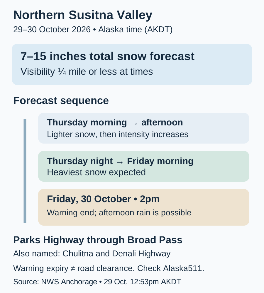
A winter storm warning for Alaska’s Northern Susitna Valley remains in effect until 2 pm AKDT on Friday, 30 October 2026. The National Weather Service forecasts total snow accumulations of 7–15 inches and visibility of a quarter mile or less at times. The warning specifically includes the Parks Highway corridor through Broad Pass.
The Anchorage office’s notice, issued at 12:53 pm AKDT on Thursday, places the heaviest snow from Thursday night through Friday morning. That timing matters for drivers planning an overnight journey or a Friday departure: the warning describes rapidly accumulating snow and potentially very difficult travel, rather than simply a cold-weather forecast. All times here are Alaska local time.
Match the warning to the route
The affected zone is Northern Susitna Valley, with Chulitna, Broad Pass and the Denali Highway named in the warning. Drivers should match their actual route to that coverage. A general search for an Alaska winter storm can return notices for different valleys and dates; this particular notice does not describe conditions across all Alaska or in Fairbanks.
The warning identifies two linked travel hazards: snow building quickly on the road and visibility dropping to a quarter mile or less at times. The 7–15-inch figure is forecast total accumulation for the event, not a measurement at every location or a report that the full amount has already fallen. The notice does not supply a detailed explanation of the storm’s meteorological cause.
The heaviest period comes before Friday afternoon
The forecast describes lighter Thursday-morning snow of 2–4 inches before intensity increases in the afternoon, followed by the heaviest period overnight and Friday morning. Those phases explain why a relatively manageable earlier journey would not establish the conditions for a later trip. Conditions can change during the same warning period.
Snow could mix with or change to rain on Friday afternoon as temperatures rise above freezing, the NWS says. This remains conditional. The 2 pm warning end and possible rain are not statements that road surfaces will immediately be clear or that every route will be safe. A weather warning and a highway condition report answer different parts of the travel decision.
Use road reports alongside the weather notice
For current road information, the NWS directs travelers to 511 or Alaska 511. The Alaska Department of Transportation and Public Facilities site provides road-condition, closure, incident and camera layers. Use those reports for the intended highway segment alongside the latest NWS notice; this article has not independently verified a current closure on the corridor.
The NWS advises anyone who must travel to carry an extra flashlight, food and water in the vehicle. Its forecast supports allowing room to change an overnight or Friday-morning plan, especially where visibility is poor. The useful threshold for proceeding is the combination of a current warning and the condition of the actual route, rather than the warning’s expiry time alone.
The dated official sources below define the scope. Scheduled or forecast events are identified as such; subsequent changes will be updated at this URL.
- NWS Anchorage: Northern Susitna Valley winter storm warning, 29 October 12:53 AKDT ↗
- Alaska DOT&PF: Alaska 511 road conditions ↗