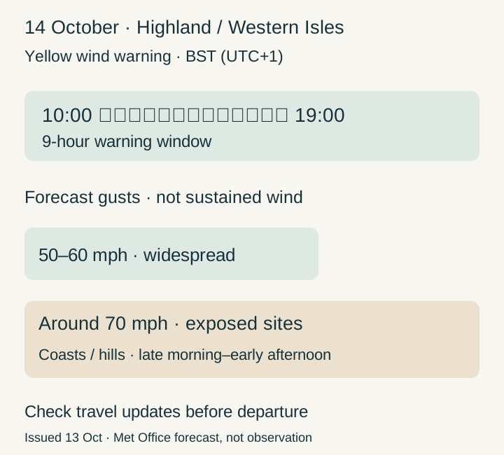
A yellow wind warning covers Highland and Na h-Eileanan Siar, the Western Isles, from 10 am to 7 pm BST on Wednesday, October 14, 2026. The Met Office forecasts gusts around 70 mph at some exposed coastal and hilly sites, rather than sustained 70 mph winds across the UK.
Issued at 8:51 am BST on October 13, the warning applies for nine hours the following day. Its timing matters for journeys through northwest Scotland. The Met Office’s October 13 outlook describes a changeable UK week, with stronger northwest winds followed by cooler conditions.
A weather system approaches from the west
The official outlook links Wednesday’s gales to a deepening low-pressure system approaching from the west. The strongest winds are expected around midday in the northwest. England and Wales have a different outlook, with much of Wednesday remaining dry and bright before western winds strengthen.
Within the warning, widespread gusts are forecast at 50–60 mph; around 70 mph is the exposed-location possibility for late morning and early afternoon. Winds should ease from the west later in the day. These are forecast gusts, not recorded measurements or a uniform speed throughout the nine-hour window.
Expected impacts within the warning area
The warning anticipates delays on roads and to air and ferry travel, possible effects on buses and trains, and problems for high-sided vehicles on exposed routes and bridges. It also allows for short-lived loss of power. Those possibilities do not establish that a particular service has been cancelled.
Yellow describes a warning that needs its individual detail read, not an instruction to assume every journey is unsafe. Here, geography, exposure and travel timing explain who should plan for delays. The forecast’s later shift to cooler air is a separate part of the week’s weather.
Prepare before travelling, then check for changes
Before setting off, check road conditions or the current timetable and amend the journey if necessary. At home, the official warning recommends preparations such as torches, batteries and a phone power pack. These are practical ways to prepare for possible disruption, rather than promises that it will occur.
Use the Met Office’s warning detail and local forecast again before the journey: warnings can change. After Wednesday, assess any reported impact against the location and time of this forecast. An exposed-site gust headline should not become a claim that the whole country experienced the same wind.
The Met Office warning and October13 outlook were read directly. The October14 BST window, local authority coverage and exposed-site gusts are forecasts. No particular service cancellation or nationwide sustained70mph wind is asserted.
AI assisted with drafting and editing. This article is part of our preview edition. Editorial standards & corrections →