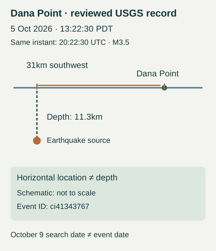
The Dana Point earthquake covered in the resurfacing reports occurred on October 5, 2026, at 1:22:30 pm PDT—not October 9. The reviewed USGS record lists magnitude 3.5, a location 31 km southwest of Dana Point and a depth of 11.3 km. Its event identifier is ci41343767, which lets readers distinguish this quake from another nearby event.
The associated local report was published on October 6, while the search-trend feed observed it again on October 9. Those dates describe publication and rediscovery, rather than a new earthquake. For someone trying to match an alert or a remembered jolt, the event time and identifier are more useful than the date a story reappears in search.
USGS reviewed event, not the story’s resurfacing date
| Field | Reviewed record |
|---|---|
| Event | ci41343767 |
| California local time | October 5, 13:22:30 PDT |
| UTC | October 5, 20:22:30 UTC |
| Magnitude | 3.5 (ml) |
| Location | 31 km SW of Dana Point |
| Depth | 11.3 km |
Current reviewed record checked October 9. Local conversion uses America/Los_Angeles daylight time.
Match the event time, location and depth
USGS gives the origin time as 20:22:30 UTC on October 5. California was on Pacific daylight time, seven hours behind UTC, so the local date remains October 5. The 31 km figure describes the location southwest of Dana Point; the 11.3 km figure is depth. They measure different dimensions and should not be combined into a single distance from a reader’s home.
The official event page is marked reviewed. Its displayed location and depth differ from older search snippets showing 30 km and 8.5 km. Use the current event record when comparing figures, and retain the event identifier if a value is revised again. This report does not identify a particular fault or a trigger for this quake: those conclusions were not established by the sources checked.
Magnitude and shaking are different measurements
Magnitude describes the earthquake at its source; intensity describes shaking at a particular location. USGS explains that intensity can vary across the affected area. On this event page, the community-based Did You Feel It? product shows III and the ShakeMap estimate shows II. These labels belong to different products, rather than two competing magnitude readings.
A magnitude value or one displayed intensity cannot establish the absence of damage at every location. This article therefore does not turn the reviewed 3.5 into a blanket all-clear, an injury count or a prediction about another quake. The practical comparison is between the dated event record and the location-specific shaking information.
Check the official record before reporting what you felt
To check your own experience, open the linked USGS event page, confirm ci41343767 and the October 5 time, then choose Felt Report – Tell Us. The form asks whether you felt the event and where you were; contact details are optional. Complete it only for the event you experienced, rather than a quake with a similar place name.
For later changes, return to the same event record and its shaking products. A newly posted story or a changing response count alone does not show that a new quake occurred. We will use this URL for revisions to this event, keeping the observation time and the original USGS link visible.
The reviewed USGS October5 event was rechecked before publication. October9 RSS activity is not a new event. Source, depth, local time and shaking products are separated.
- USGS reviewed event ci41343767 ↗
- USGS event-specific Felt Report ↗
- USGS explanation of magnitude and intensity ↗
- edhat October6 report of the October5 event ↗