A weakening polar vortex does not by itself forecast a US-wide freeze. NOAA’s Climate Prediction Center outlook issued November 6 favors above-normal temperatures in the western and central contiguous US for November 12–16, with near- to below-normal conditions in the eastern third and the cooler tendency closest to the Atlantic coast. These are regional period-average tendencies, not a daily forecast for every town.
Fresh coverage on November 6 drew attention to an unusually early weakening high over the Arctic. In its October 31 monthly discussion, CPC had already flagged a possible sudden stratospheric warming and competing influences from El Niño. That dated warning explains why the event matters without turning a model signal into a confirmed local cold outbreak.
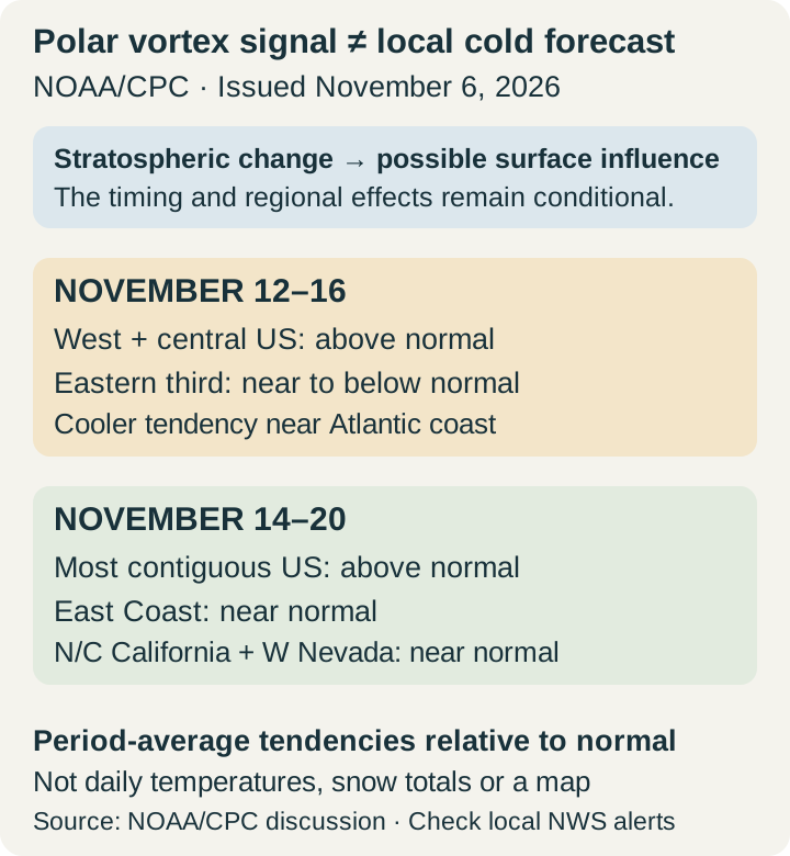
The upper-atmosphere signal and surface weather are different steps
A major sudden stratospheric warming is assessed using daily-average winds around 60 degrees north at 10 hPa, roughly 30 kilometres above the surface. A reversal of those winds is part of the event criteria; a stretched-looking vortex alone is insufficient. NOAA’s published compendium supplies the definition and a historical table updated in 2023, rather than a live confirmation of a 2026 record.
Atmospheric waves rising from below can slow the circulation and warm the polar stratosphere. Changes can subsequently influence lower-atmosphere circulation, but their timing and regional effects vary. CPC’s monthly discussion explicitly notes that possible eastern-US effects can compete with El Niño. The older October 28 World Climate Service model snapshot likewise describes a forecast, not later observations; its ensemble-member shares are not calibrated chances of snow or cold at a location.
What the November 6 regional outlook actually says
For November 12–16, CPC favors warmth relative to normal over the West and central US, while the Atlantic Seaboard is favored to be cooler than normal. It also notes that overnight lows could approach freezing in parts of the Ohio and Tennessee valleys later in that period, a possibility it describes as ordinary for mid-November. A near-freezing night and a period-average temperature tendency answer different questions.
The November 14–20 window is broader in its warmth signal, favoring above-normal temperatures across most of the contiguous US. Near-normal conditions are favored along the East Coast and over northern and central California and nearby western Nevada. Moving between the two windows without retaining their valid dates would erase those differences; neither outlook promises the same temperature every day.
Use regional guidance for planning and local forecasts for action
NWS guidance directs residents to weather.gov for their own area’s forecast and recommends reviewing home and car emergency kits at the start of winter. For a trip, compare the location and travel date with the latest local forecast and alerts, rather than using the vortex headline as a departure-day prediction. CPC’s daily outlook and its issue date provide the wider context as those local forecasts evolve.
The useful finding is a regional contrast in a dated official outlook, alongside an uncertain upper-atmosphere development. Cooler Atlantic-coast tendencies can coexist with favored warmth farther west, and a broad warm tendency does not rule out individual cold nights. A nationwide freeze, its duration or a snow date cannot be read directly from the polar-vortex signal.
Prepared from the original records and attributed reporting below. Issue dates, applicable periods, format and uncertainty are retained.
- NOAA/CPC: November6 discussion, validNov12–16 andNov14–20 ↗
- NOAA/CPC: October31 updated November monthly discussion ↗
- NOAA/NWS: What is the Polar Vortex? ↗
- NOAA/CSL: SSW compendium definition and historical table ↗
- World Climate Service: October28 forecast snapshot ↗